+
Active Clients
Our Location
Reg Add:- "Mauli Krupa",Somdwar Colony, Plot# A-5, Ramnagar, Rahatani, Pune-411017
Precision Mapping, Geospatial Analytics & Digital Transformation, Strategic Solutions for Business Growth
Years Experience
Projects Delivered
Clients Nationwide
Success Rate
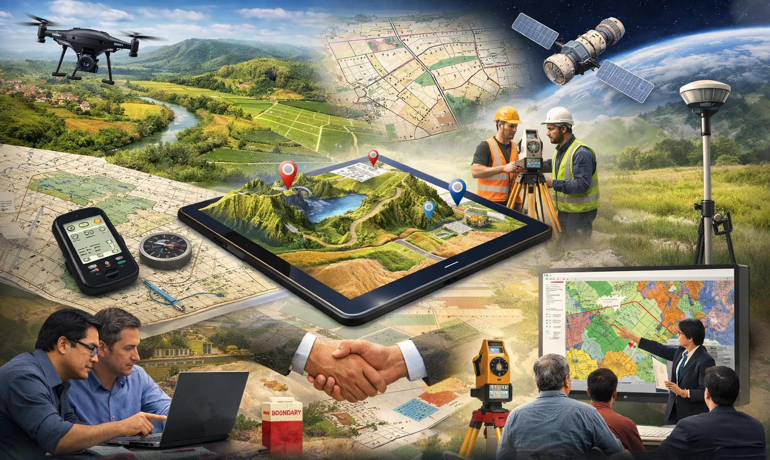


Aurexion Geospatial Services (Formerly NAAGAR GeoInfo Services) specializes in GIS Mapping, Geospatial Analytics, Survey Engineering, and Advanced IT Consultancy services for government and enterprise sectors.
We are located at Pune, Pimpri-Chinchwad. our founder and team having 19+ year experience in GIS Industries. We provide Geospatial Soultions and Services in Remote Sensing and GIS Activity to government and non government areas with the help of Ground/Field Survey as per the requirment of the Project.

Director & Founder
Call us anytime
+91-9630001355 / 9067673355

of experience in GIS service
GIS services transform complex spatial and geographic data into clear, actionable insights through advanced mapping and analysis. These insights help organizations make smarter decisions, optimize resources, and solve real-world problems effectively.
Our core services combine technology and geospatial expertise to create accurate and impactful spatial solutions.
Provide accurate spatial data analysis using satellite and aerial imagery. These solutions help organizations visualize geographic information and support effective planning and decision-making. 🌍🛰️
Provide practical learning to help individuals & organizations understand GIS tools & geospatial technologies. We offer hands-on training to build skills in GIS applications, mapping techniques, and spatial data analysis.🎓🗺️
Provide expert guidance to help organizations plan, implement, and optimize GIS-based solutions. We support data analysis, mapping strategies, and geospatial decision-making for efficient project development. 🌍📊
Using high-resolution satellite imagery and hybrid mapping techniques, we create highly accurate City Base Maps, Land Use Land Cover (LULC) maps, and Cadastral maps. We also perform time-series change detection analysis to support effective planning and decision-making for Urban Local Bodies and private organizations. 🌍🛰️📊
Our services include DGPS surveys, topographic mapping, and drone-based photogrammetry to capture highly accurate ground and elevation data. Using advanced geospatial technologies, we generate precise spatial datasets for infrastructure, planning, and development projects. 🌍🛰️🗺️
We provide Forest Land Clearance Mapping services to support regulatory approvals and facilitate the land acquisition process through accurate geospatial analysis. Utility mapping of drainage, water supply, fiber optic, gas, electrical, and road networks can be carried out using GIS to support infrastructure planning. 🗺️🏙️
Next-generation digital tools delivering precise mapping, spatial analysis, and reliable geospatial insights.
Harnessing advanced GIS, remote sensing, and data-driven technologies to deliver smarter, faster, and more accurate geospatial solutions. 🚀

Our solutions are built for speed and efficiency, ensuring lightning-fast processing of complex geospatial data. With advanced GIS technologies and optimized workflows, we deliver rapid mapping, analysis, and visualization that helps organizations make faster and smarter decisions. ⚡
We provide advanced digital solutions that integrate modern geospatial technologies with powerful data analytics. By transforming complex spatial information into clear and actionable insights, our solutions support for both public and private sectors. 🚀
Through advanced integration techniques, we bring together diverse geospatial datasets into one connected environment. This allows organizations to easily manage, analyze, and visualize data while maintaining accuracy, consistency, and real-time accessibility
Our smart analytics approach combines GIS technology, data visualization, and spatial intelligence to uncover hidden patterns in geographic data. This helps organizations make faster decisions, improve planning accuracy, and achieve sustainable development goals.
Discover powerful features designed to elevate your business operations to the next level of excellence.
Empowering urban development projects with satellite imagery analysis, DGPS surveys, and precise geospatial mapping. Supporting government and private sector infrastructure initiatives with reliable location intelligence.
Infrastructure development with high-precision GIS mapping, drone surveys, and geospatial data analysis. Providing accurate spatial intelligence for roads, railways, utilities, and large-scale construction projects.
Geospatial solutions for digital city planning, infrastructure mapping, and asset monitoring. Helping government bodies implement smart city technologies with accurate and scalable spatial data systems.
Accurate GIS mapping and cadastral survey solutions for digital land record management. Supporting government departments and authorities with precise land parcel mapping and boundary verification.
“Your trusted partner delivering precise geospatial solutions, accurate mapping, and intelligent insights through advanced technology and expert knowledge.”
Accurate geospatial data and mapping solutions through advanced GIS, Remote Sensing, DGPS, and drone technologies for effective planning and decision-making.
From data collection to analysis and mapping under one platform. We provide tailored geospatial services to meet the specific needs of government bodies, urban planners, and private organizations.
Solutions designed according to the needs of Urban Local Bodies, government agencies, and private organizations and Focused on building long-term partnerships through reliable service delivery 🛰️🗺️.
Our experienced professionals ensure high-quality geospatial analysis and mapping solutions with utilize modern satellite imagery, GIS software, and survey techniques for efficient results.


Take the next step toward smarter decision-making with our comprehensive geospatial services. From data acquisition and mapping to spatial analysis and consultancy, we help organizations transform complex spatial data into clear, strategic solutions for effective planning and development.
What we've done
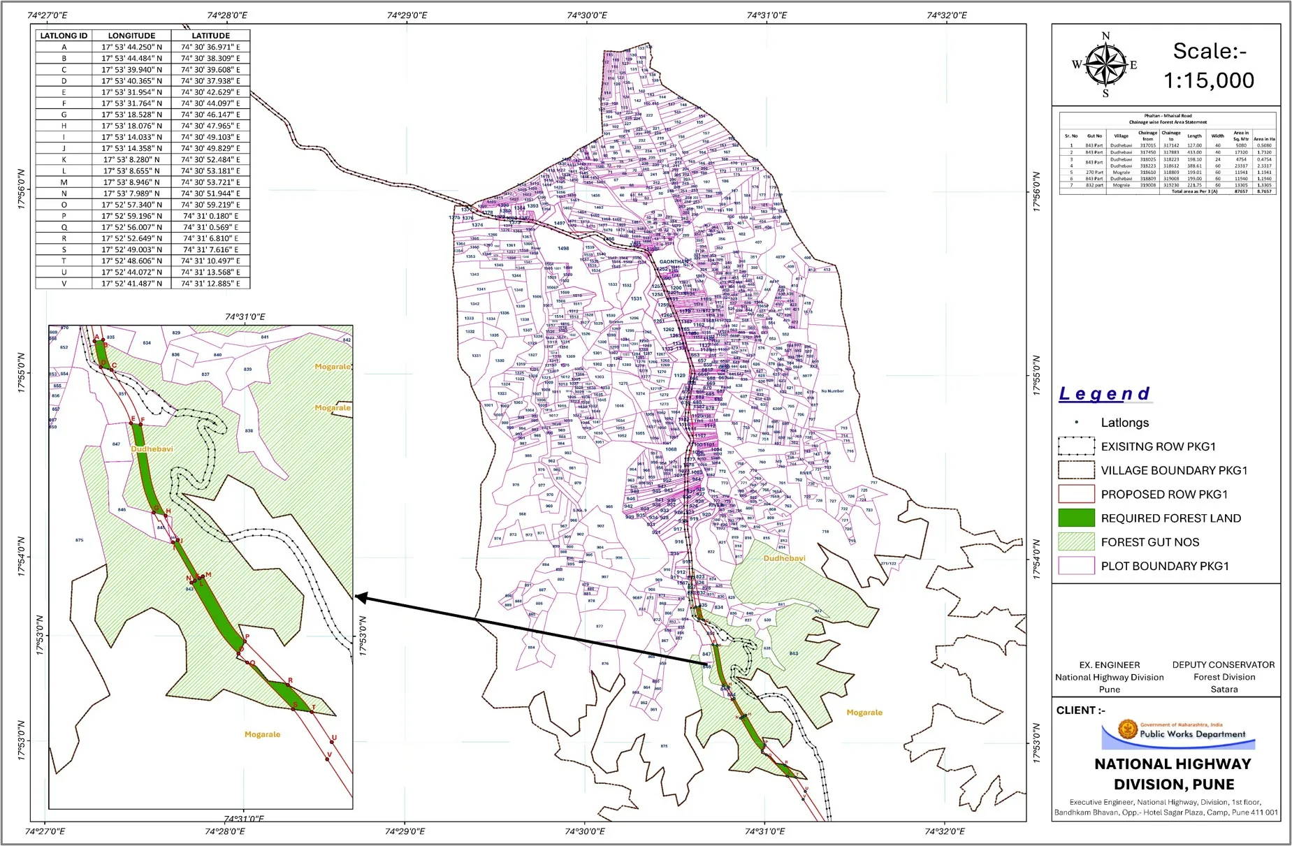
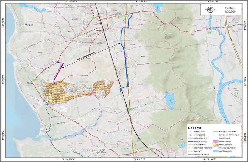
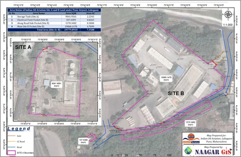
Approval for Land Aquisition Process
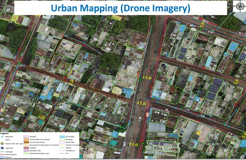
Drone Imagery and Urban Mapping
Orthorectifcation and Geoprocessing
Road Design Planning with Approached Roads
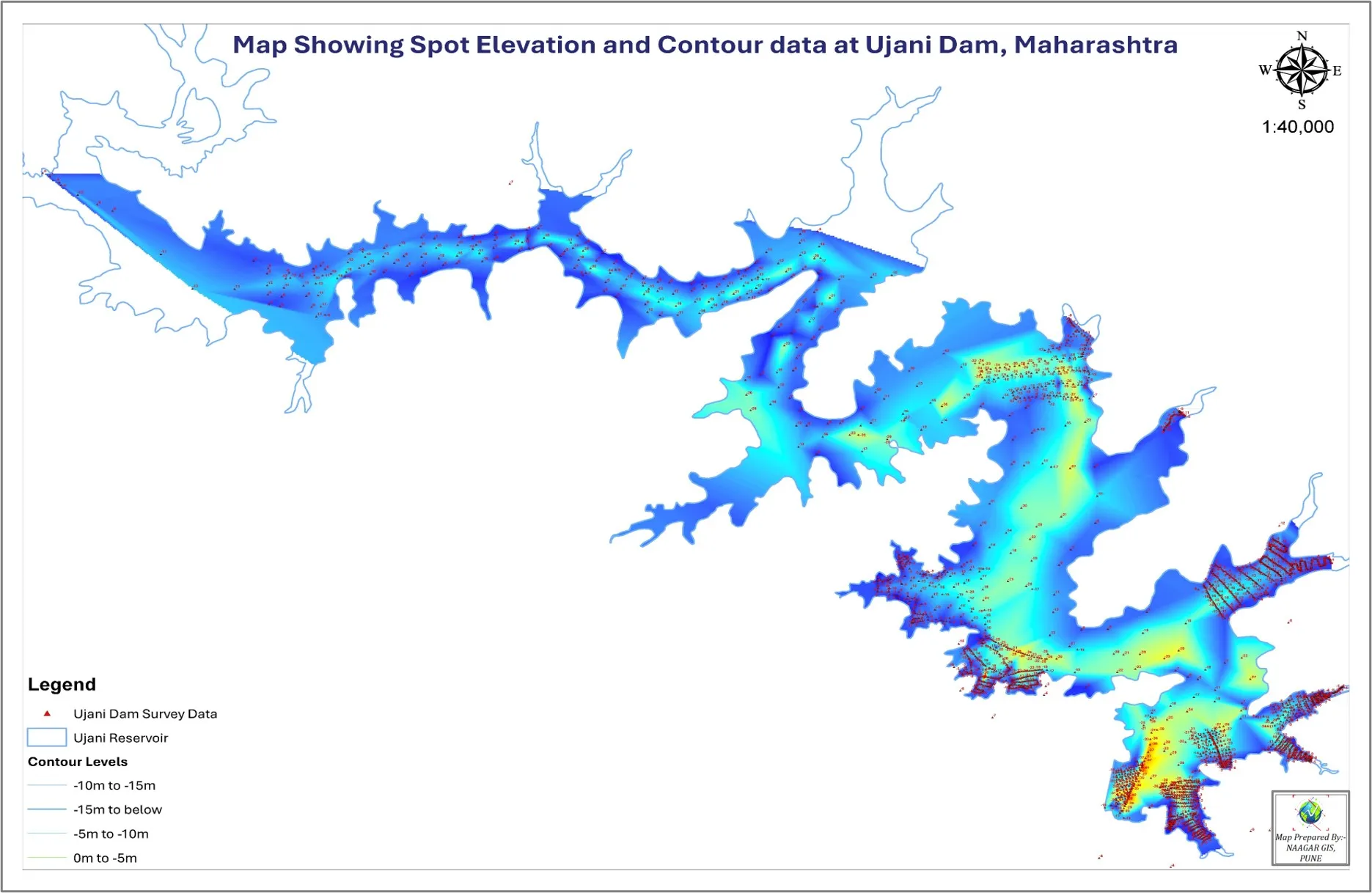
Under Water Spot Elevation and Contour Mapping
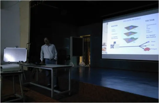
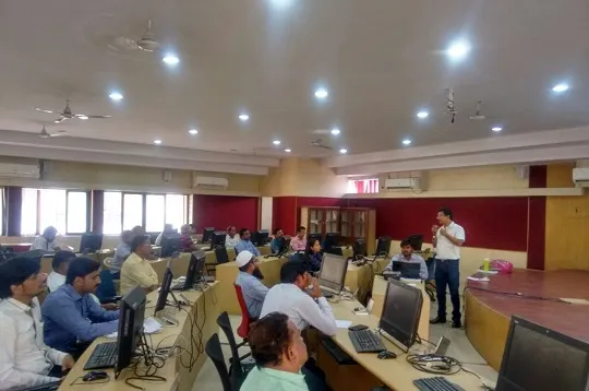
Basic GIS Overview Training to Officers
Departmental Application Training to Officers
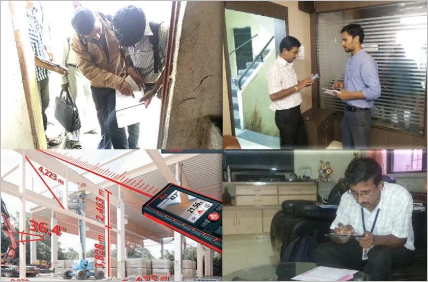
Property Information Survey for Taxation
Various Utility Mapping on GIS Platform

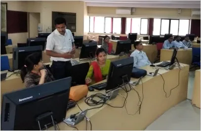
GIS Application Training to Students
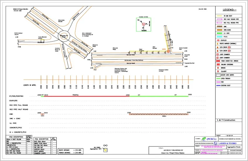
Fiber Network As Built Drawing
Boundary Demarcation Using Hybrid Technique
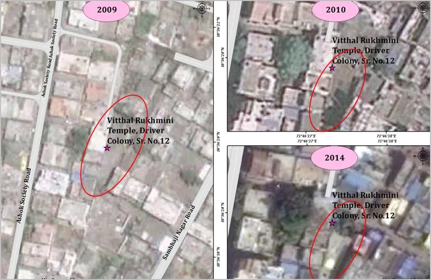
Change Detaction Using Hybrid Technique
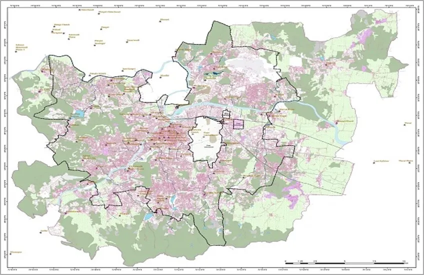
City Base Map
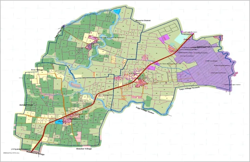
Land Use and Land Cover Map
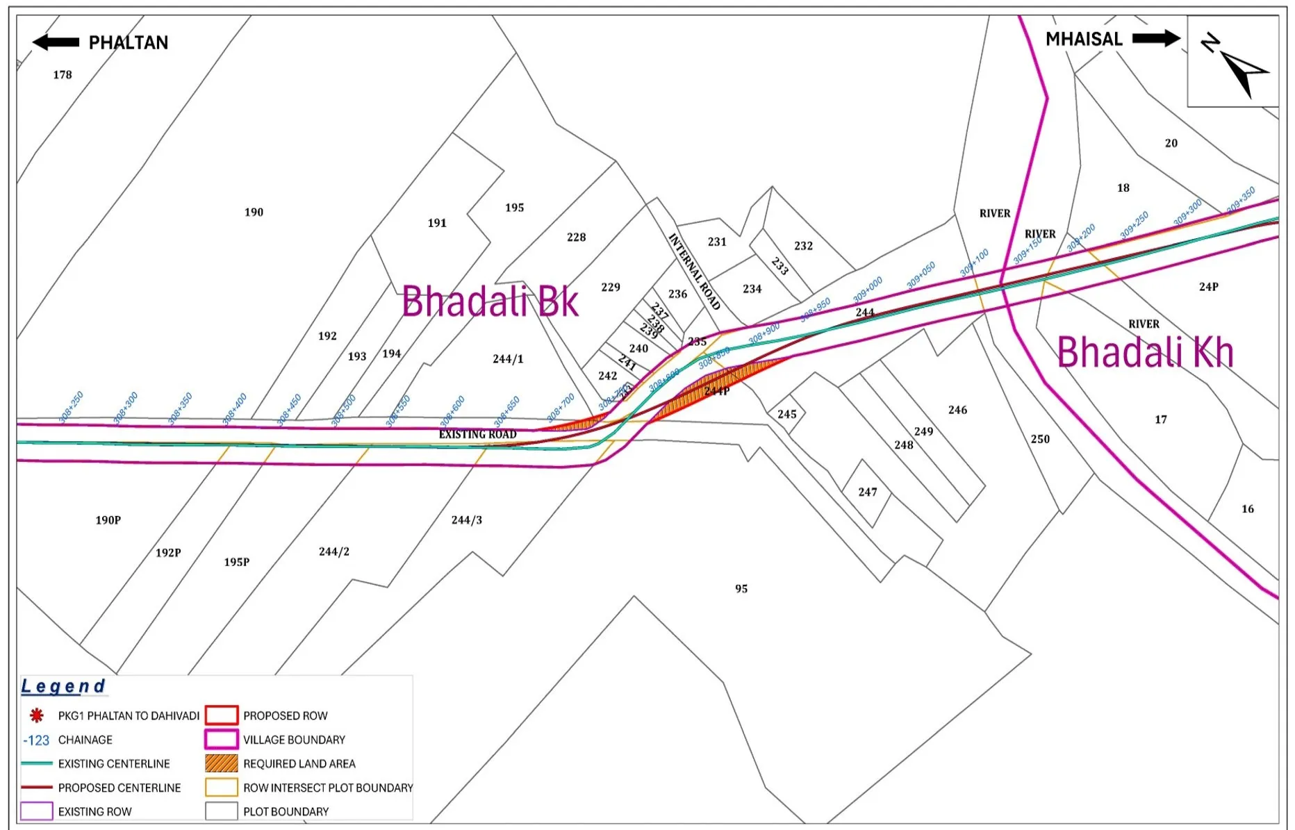
Proposed Land Aquisition Activity Using Hybrid Technique for National Highway
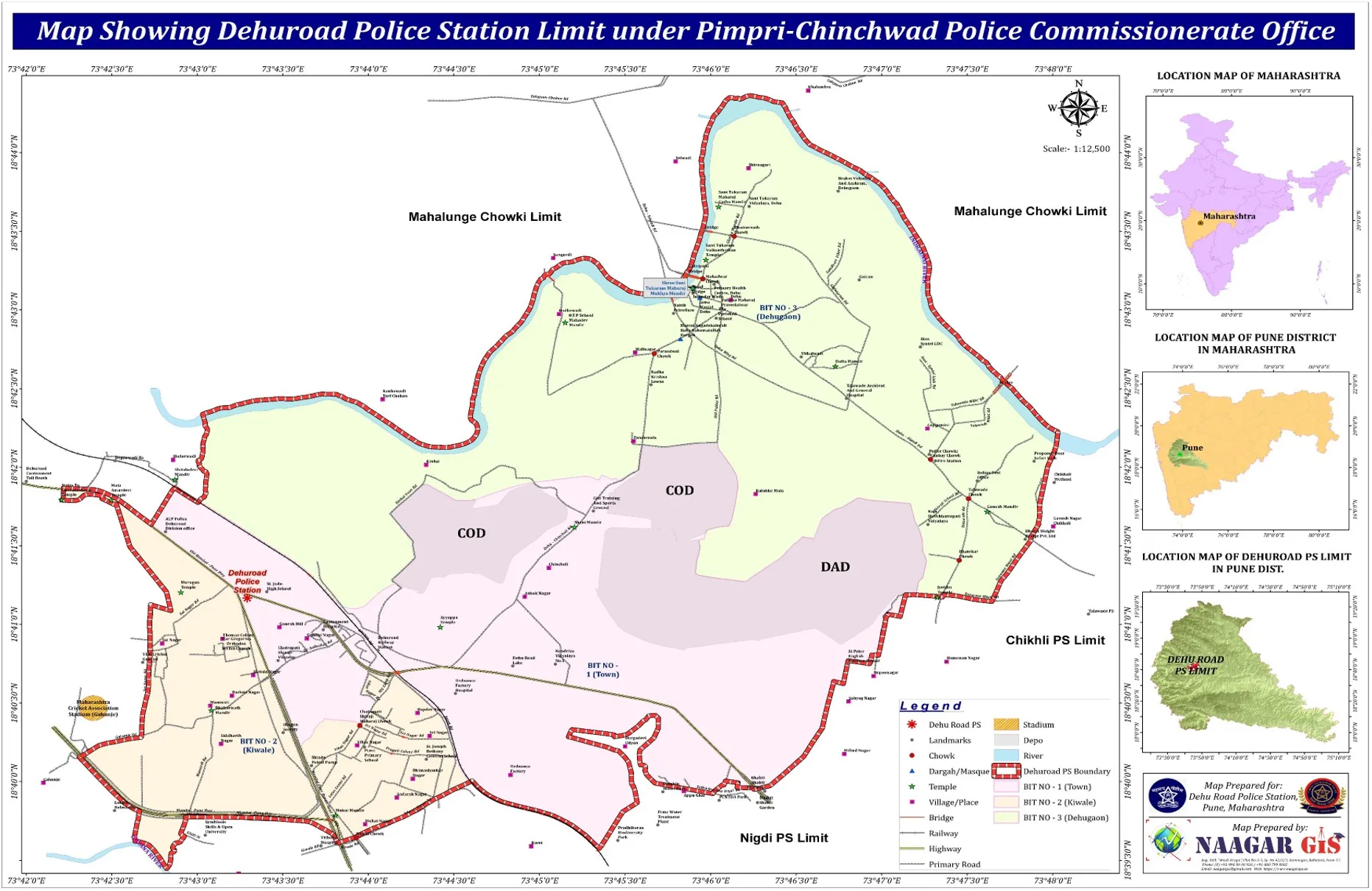
Police Station Boundary Limit Mapping Using Hybrid Technique
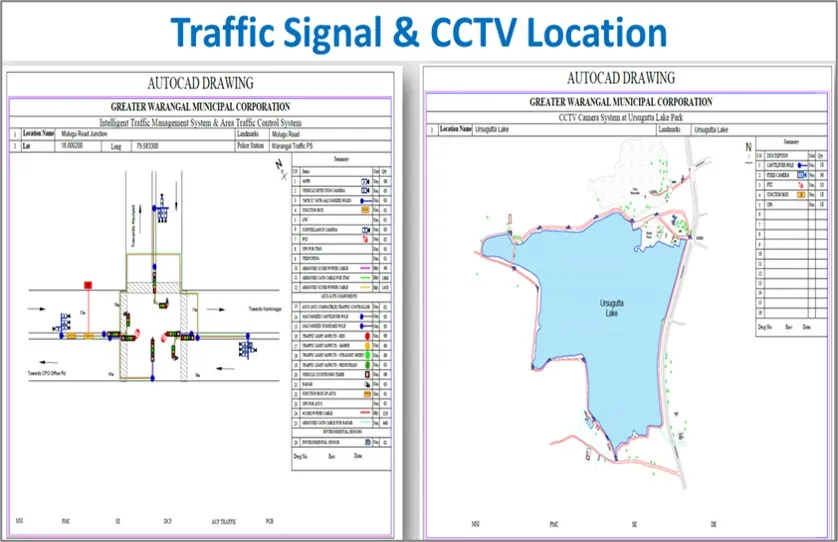
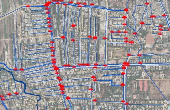
Traffic Signal and CCTV Locations Mapping
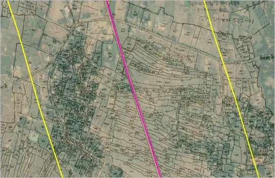
Hybrid Technique use for any Land Aquisition process
AUREXION GEOSPATIAL SERVICES Formerly name as NAAGAR GEO INFO SERVICES
Reg Add:- "Mauli Krupa",Somdwar Colony, Plot# A-5, Ramnagar, Rahatani, Pune-411017
+91 963 000 1355
+91 90 67 67 33 55
gis.aurexion@gmail.com
ags@aurexiongis.com